We present...
Our Executive Summary!
WHY?
The need that the growth of cities do not compromise the sustainable development of the territory is nowadays a topic of high interest globally, and a major challenge both for public and private sectors. Reinforcing the role of urban planning and management, improving the efficiency of mobility in cities, adapting the built park to the new needs of human activities, qualifying public space, are some of the biggest challenges. To monitor city environment evolution, its constructions and infrastructures, is essential, and it will certainly be maintained on the agenda for the next decade.
Simple challenges like clarifying licensing procedures and construction processes require on-field analysis by several services, while non-licensed activities are known to be highly corrupted and bring financial implications to the public accounting. Remote sensing and Earth Observation techniques may help on the territorial analysis reducing operational costs in the monitoring of the construction, increasing also the revenue due to minimization of illegal construction.
OK...BUT HOW?
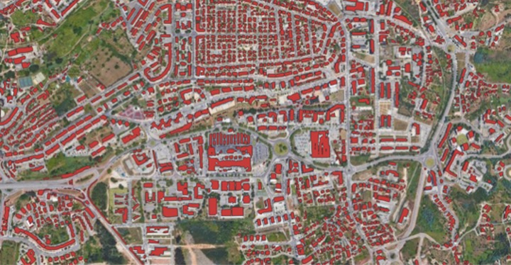
Satellite remote sensing is the main data used in change detection. It provides a consistent source for the characterization of urban land use/ cover types and their change over space and time. The approach used to detect change compares two satellite remote sensing images taken in different times (bi-temporal data), one image in time1 and the other in time2. The preprocessing of remotely sensed data includes geometric rectification and image registration, radiometric normalization and atmospheric correction, and topographic correction if the study area is a mountainous region. It may rationalize changed or new construction areas, excavation volume or even to know the effective height of construction in (near)-real time, without the need of an on-site inspection.
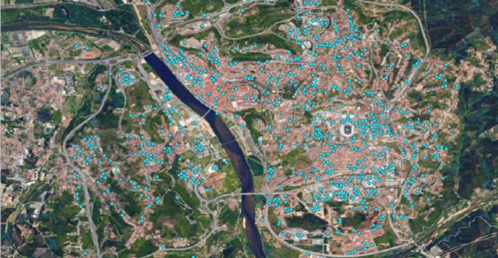
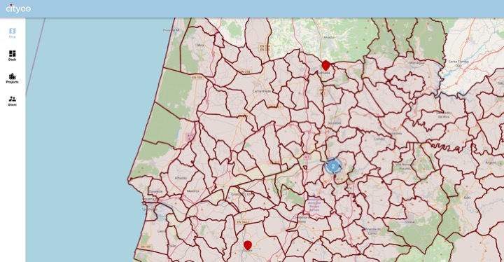
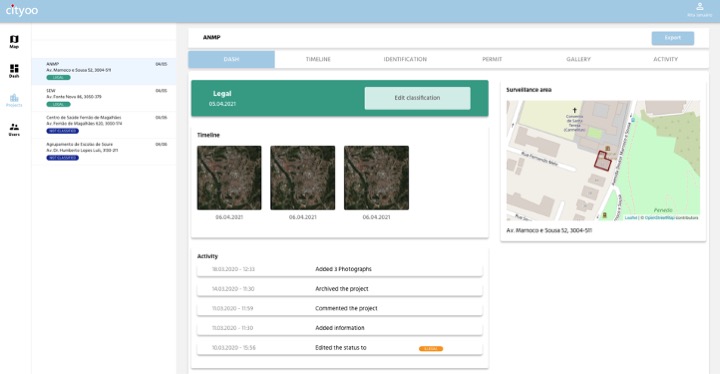
With this in mind Cityoo was developed, a near-real time digital platform combining Earth Observation imagery, other sources of data available and powerful algorithms.
Not only the public sector will benefit from the solution, but also it can be the catalyzer agent for best practices to the private sector. The model presented is framed within the parameters of Innovation and Infrastructure, Sustainable Cities and Communities. Throughout the development, during the recently Incubation period in Business Incubation Center from European Space Agency (ESA BIC), was perceived that Cityoo may not only be applied to control buildings construction, but were also identified other business opportunities, such as, applications in forests (where is the need to understand deforestation, fire safety measures, etc), land settlements which can be warning signs, tears in the roads so that the municipalities are able to correct these issues in a timely manner. All these new perspectives give security to the service and business model.
YOUR SOLUTION?
The solution is a software-as-a-service that through an annual subscription model allows any territory manager to have access in near-real time to its changes, enabling more assertive inspection and prevention actions. Every time a noncompliance is detected the territory managing authority will be automatically notified. It is foreseen that within the prevention and citizenship framework, citizens will also have access to the monitoring that the platform is performing. Cityoo will enable the growth of income for the licensing entities and the licensing, allowing for inspection resources optimization, through the digitalization and dematerialization of processes, decreasing therefore the approval time of projects.
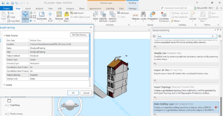
The ambition is to continuously develop the platform and increase the level of services, adding Building Information Models (BIM) data is certainly a way to achieve this.
BIM...WHAT'S THAT?
BIM methodology, or Building Information model, is a construction virtual model, equivalent to a real edification. BIM is a collaborative 7D (7 Dimensions) model that combines construction digital process and operational assets enables the understanding of a building behavior before the beginning of its construction, anticipating also all conservation actions during its lifespan. BIM includes geometry, spatial relations, geographic information, work measurements, construction deadlines and component constructive properties, so that it can demonstrate the building life cycle: construction processes, installation and maintenance, and deconstruction at the end of the lifespan.
Associating satellite imagery and outcomes provided on the territory for the implementation of BIM, public entities and regulators will be able to follow the exact evolution of all the constructions at any time. This will guarantee that all the changes taking place are in accordance with the strategic planning previously defined and that the projects are executed as approved.